| english español |
| 1 for 1 Lessons for Zafirah |
  |
For larger, downloadable, images click here.
Rollover map to see film location details.
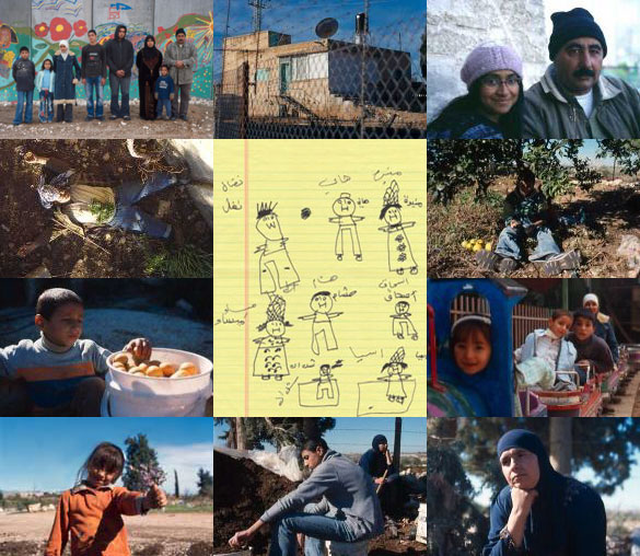
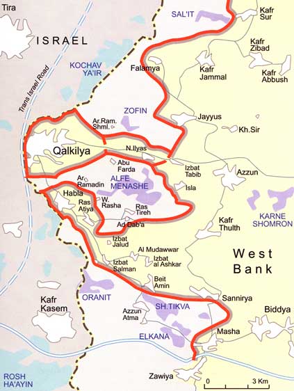
Phase A of The Wall runs 160 kilometres down the western side of the West Bank, encircling Palestinian Qalqiliya and enfolding numerous Jewish settlements (marked in purple) into de facto Israeli territory. This first phase of The Wall ends just a few hundred yards beyond the Amer family's house. When Hani needs to go to the land with his family, they must travel 20 kilometres by car, around the wall and through the checkpoint between Beit Amin and Azzun Atma. When Hani goes alone, he travels three kilometres by donkey, through gates sporadically manned by Israeli soldiers. All uncredited photos on this site © Copyright Daoud Sarhandi and Carolina Rivas. Map: HDIP. |
||||